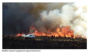
Photo supplied

In partnership with Fire and Emergency New Zealand (FENZ), Te Whare Wānanga o Waitaha | University of Canterbury (UC) students George Hamilton and Renee Martin were part of a team that examined the effects of factors such as fuel load, vegetation type, and proximity, on fire risk.
“Our research focused on identifying and mapping hedgerows and shelterbelts in rural Canterbury, analysing their characteristics, and understanding how these features influence fire behavior,” Hamilton says.
The research held personal significance for him. “My childhood neighbour’s house burnt down due to a hedgerow fire that spread for about 2 kilometres. That experience stayed with me and motivated my interest in this topic.”
Supervised by Associate Professor Marwan Katurji from UC’s School of Earth and Environment, the Science students began by mapping West Melton hedgerows and shelterbelts to understand their geospatial relationship with infrastructure.
“This student project is contributing to understanding the risk of wildfire in the household environment, using fuel distribution and potential fire behaviour to inform safe living. The students’ methodology was informed by geospatial data analysis and community and stakeholder engagement to assess and communicate the risk better,” Associate Professor Katurji says.
“This pilot research aligns well with FENZ’s ongoing national wildfire threat analysis programme. Identifying new fuel types in our rural-urban landscape will help in fire behaviour prediction and firefighting resource allocation.”
Hamilton says Canterbury has a significant number of hedgerows and shelterbelts near rural infrastructure but, despite this, there is limited research on their role in fire risk.
Part of the research project was to create mitigation strategies based on their findings, Martin explains. “We discovered that native plantings, creating breaks in shelterbelts and planting hedgerows and shelterbelts further from buildings are key to reducing fire risk,” she says.
In addition to this the team created a risk index to help identify high-risk areas. “By understanding the patterns and characteristics of hedgerows, communities can reduce fire impact before it starts and respond quicker when fires start,” Hamilton says.
As part of a compulsory third-year course, Research for Resilient Environments and Communities, for Bachelor of Science students majoring in Geography and Environmental Science, the project challenged students to tackle real-world issues, something Martin says she found particularly rewarding.
“One of my key takeaways was learning to collaborate with a community partner, which required adaptability and delegation,” she says.
“The project highlighted the value of working with partners like FENZ. It allowed us to apply classroom and lab knowledge to real-world situations while also upskilling our data analysis skills.”
FENZ Wildfire Scientist Grant Pearce says “student projects like this are a great way to initiate new research. The students provide new ideas and approaches that we may not be aware of, and which can lead to better outcomes. FENZ will look to use this partnership approach again next year.”
The team sees significant potential for scaling up the research nationally and internationally.
“We looked at our research limitations and found that with more skills, time, and technology we could enable more precise differentiation of hedgerows from other vegetation and structures,” Hamilton says.

